
Making Airspace Authorization Part of the Public Safety Mission
When a 9-1-1 call comes in, every second counts. Drone as First Responder (DFR) programs are built around exactly that moment. By getting an aerial view of an incident before ground units arrive, DFR gives responders valuable context to inform decisions and coordinate their response.
Getting an aircraft into the air is only one part of that mission. Agencies must also manage airspace authorization, understand surrounding activity and maintain awareness even as conditions change. Integrating the right tools and information into the response workflow helps pilots manage this added complexity alongside their operational responsibilities.
Under 14 CFR Part 107, flights in controlled airspace generally require FAA authorization. This includes Class B, C and D airspace, as well as certain Class E airspace designated for an airport. As these areas can extend over the communities public safety agencies serve, authorization requirements are an important consideration in DFR planning.
For agencies building or expanding their programs, the opportunity to connect airspace authorization, awareness and response into a single, responsible approach to flight operations can strengthen both community and responder safety.
Bringing Airspace Authorization into the Response Workflow
Consider a typical DFR call. From dispatch to launch, authorization requirements need to be addressed without losing sight of the incident.
Dispatch creates the incident.
The call is entered into the computer-aided dispatch (CAD) system, and the pilot prepares for launch.
The pilot confirms authorization requirements.
If the planned flight requires FAA airspace authorization, the pilot must obtain the required approval before proceeding.
Mission details carry through the workflow.
Connecting airspace authorization with operational processes reduces switching between applications, duplicate data entry and manual reconciliation, allowing pilots to focus more time on flight preparation and response.
Workflow integration does not replace regulatory requirements or the FAA’s role as the airspace authorization authority. Flights requiring additional coordination or waivers must still follow applicable processes. The goal is to reduce administrative steps while maintaining required approvals and compliance checks.
Turning Airspace Awareness into Community Protection
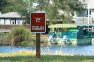
Most civilian aircraft are used for legitimate purposes, including recreation and commercial work. However, unauthorized or unsafe flights near correctional facilities, critical infrastructure, public gatherings and more can raise safety and security concerns.
By reviewing planned-flight information, airspace authorization records and detection data together, public safety personnel can gain a clearer picture of aerial activity and determine whether further investigation is needed.
- Expected Activity: An aircraft aligns with available planning or authorization information and appears consistent with the operational context.
- Unidentified Activity: An aircraft has no readily identifiable match in available records. Personnel may seek additional information, including Remote ID data where available and applicable.
- Activity Requiring Further Assessment: An aircraft’s location, behavior or surrounding circumstances raise safety or security concerns, such as activity near a sensitive facility, public gathering or active incident.
These categories give teams a consistent framework for evaluating aerial activity without making assumptions about intent. An unmatched aircraft is not automatically a threat, just as an authorized flight is not beyond scrutiny. Each situation must be assessed in context, considering the aircraft’s location, surrounding conditions and observations from personnel on the ground.
From Awareness to Action
At a large public event, multiple agencies may need to coordinate their responses while drones operate nearby for public safety, commercial or recreational purposes. Understanding expected activity helps these teams move from assessment to action.
By bringing flight plans, airspace authorization records and detection data together, agencies are equipped to evaluate activity in context and determine how to respond. Establishing clear procedures for assessing concerns and coordinating a response empowers agencies to turn airspace awareness into informed decisions, helping them operate safely and scale with confidence.
Six Principles for Effective Airspace Management
Putting these practices into action requires a consistent approach to planning, authorization and awareness. Agencies can use these six principles to evaluate their current workflows and identify opportunities for refinement.
Integrate authorization into mission planning.
Identify authorization requirements early and incorporate them into established flight planning workflows.
Keep mission information connected.
Carry relevant incident details, flight plans and authorization records across supported workflows to reduce duplicate entry and maintain operational context.
Maintain clear flight records.
Link authorization details to the corresponding flight to support traceability, after-action reviews and accountability.
Anticipate operational requirements.
Identify locations, routes and mission types that may require additional approvals or lead time, allowing teams to plan around potential constraints.
Combine multiple sources of flight information.
Consider planned, authorized and detected activity together to help personnel distinguish expected operations from observations that may warrant investigation. No single data source provides a complete picture.
Define procedures for assessing potential threats.
Establish clear responsibilities for reviewing unexpected activity, sharing information, documenting decisions and coordinating with appropriate authorities. Ensure procedures reflect the agency’s jurisdiction and operational capabilities.
Together, these principles connect planning and authorization with ongoing awareness, risk assessment and coordinated response. They also provide a framework for evaluating current processes and identifying opportunities to strengthen operations as programs evolve.
Making Airspace Authorization Part of Every Response
A successful DFR program requires agencies to look beyond the flight itself. Understanding surrounding airspace activity and recognizing when conditions warrant further assessment help teams make informed decisions when they matter most.
Versaterm Airspace brings data from multiple sources together to provide a broader view of airspace activity, helping agencies coordinate operations, assess potential risks and support safer drone operations.
Discover how Versaterm Airspace brings authorization, detection and airspace awareness together to strengthen public safety operations.


